Te Aro Pā - Te Aro Pā
Map of Te Aro Pā
This Te Aro map (Te Aro Pa, Wellington - Map C.1. No 2.) appeared in the Appendices to the Journals of the House of Representatives in 1871 (p. 55), showing all the Te Aro pā properties together with grantees.
Thank you to Wellington City Council's Information Technology mapping team for preparing this overlay which shows the map compared to properties, land and streets today.
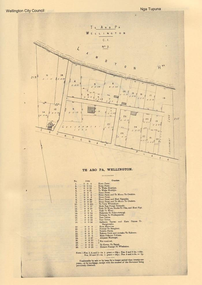
Te Aro Pā, Wellington - Map C.1. No 2. In Appendices to the Journals of the House of Representatives in 1871 (p. 55)
'The beach at Te Aro' Painting
This view looking along the beach from the Te Aro Pā area (modern Taranaki St/Manners St intersection) is the work of S.C. Brees, (Late Principal Engineer and Surveyor to the New Zealand Company), and engraved by Henry Melville.
It graces the back cover of the Library's publication Nga Tupuna o Te Whanganui-a-Tara.
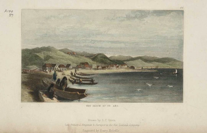
Brees, Samuel Charles, 1810-1865. The beach at Te Aro [Engraved by Henry Melville] drawn by S C Brees. Ref: A-109-037. Alexander Turnbull Library, Wellington, New Zealand.